 Tsunamis: Be Prepared and Stay Safe!
From Clatsop County, OR Emergency Management
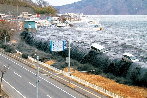
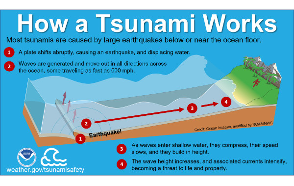
A tsunami is a series of waves usually caused by an undersea earthquake. As these waves enter shallow water near land, they increase in height and can cause great loss of life and property damage. The first wave is often not the largest; successive waves may be spaced many minutes apart and continue to arrive for several hours.
Near-shore or distant
Tsunamis may be caused by an earthquake near shore, such as one generated at the Cascadia fault line, or they may be spawned by a quake hundreds or thousands of miles away.
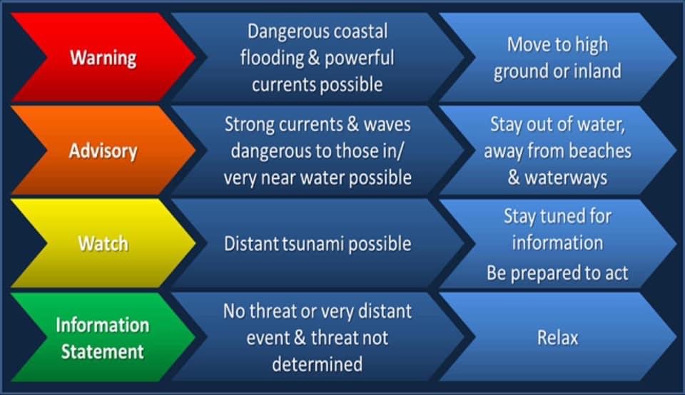
In the case of a near-shore earthquake, the first wave will reach the coast in as little as 15 minutes. In that event, get to high ground immediately once the quake ends. Do not wait for a siren or other official warning.
A tsunami generated by a distant earthquake, on the other hand, may take several hours to reach the Oregon Coast, and emergency officials will provide warnings through local radio broadcasts. Some local communities also have their own public warning systems – if you hear a solid three-minute siren blast, that’s the signal to evacuate.
A sign of an impending tsunami is often a sudden change in the sea level. If you are at the beach and witness the sea level suddently rise or fall, quickly get to higher ground.
Distant tsunamis are generally smaller than those generated nearer to shore, but can still cause considerable damage.
Tsunami Maps
In June 2013 the Oregon Department of Geology and Mineral Industries (DOGAMI) released new maps showing tsunami inundation zones, evacuation routes and assembly points for communities in Clatsop County. These maps, drawing on the latest scientific data, identify those areas at risk of inundation from both a projected worst-case local, Cascadia zone tsunami, and a worst-case distant generated tsunami.
| Interactive Tsunami Maps |
Maps are available for:
- Arch Cape
- Astoria
- Cannon Beach
- Seaside & Gearhart
- Sunset Beach & Del Rey Beach
- Warrenton
- Youngs River Valley
To find out more go DOGAMI’s Tsunami Clearinghouse website.
Staying Safe Where the Waves Break
 Where do I evacuate?
- Go to an area 50 feet above sea level, if possible.
- If you don't have time to travel to high ground, but are in a multi-story building, go to an upper level of the home or building.
- If you are on the beach and unable to get to high ground, go inland as far as you can.
-
Go on foot if possible, particularly if an earthquake has caused damage to roads, power lines, and resulted in significant debris. - Do not return to shore after the first wave – tsunamis usually occur as a series of waves. Wait until the official tsunami warning or alert has been lifted. .
- Never go to the coast to watch a tsunami. Tsunamis move faster than a person can run.
Evacuation signs and what they mean
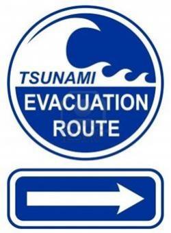
Tsunami evacuation routes were developed to assist coastal residents and visitors find safer locations in case of an earthquake and tsunami. Evacuation signs have been placed along roadways to indicate the direction inland or to higher ground. In some places, there may be more than one direction available to reach safer areas. These routes may be marked with several signs showing additional options for evacuation.
Preparation and planning
- Find out if your home, place of work and other locations you frequent are within the tsunami inundation zone. These are the areas deemed vulnerable to flooding in the event of a tsunami. Go to the DOGAMI Tsunami Clearinghouse website to find evacuation maps that include sites you and your family frequent..
- Know your route to safety. DOGAMI’s tsunami maps show evacuation routes away from areas subject to possibly inundation, as well as designated assembly areas out of the flood zones.
- Have a three-day disaster kit ready.
For more information, check out the TsunamiReady Program from the National Oceanographic and Atmospheric Administration (NOAA).
Click here for information on flood preparation and response.
